If you drive a motorhome, caravan or campervan, the questions that keep you up at night are rarely about horsepower. They are about height, width, weight and whether the road ahead will actually let your outfit through. A standard car sat nav has no idea how tall you are, so it happily sends you down a lane that ends at a low bridge - and reversing a six-metre vehicle out of a Devon hedge is nobody's idea of touring.
This is a plain-English FAQ for UK motorhome and caravan drivers. Below are the questions owners ask most often, answered with clear next steps rather than jargon. Where a vehicle-aware sat nav app helps, we say so. Where the answer is simply "check the sign", we say that too.
Why can't I just use a normal sat nav in a motorhome?
Because a normal sat nav routes for a car. It knows nothing about your height, width, length or weight, and it cannot tell you whether the next left turn leads to a 2.9 m bridge or a weight-limited lane. Those restrictions exist precisely to keep larger vehicles out, and a car profile will drive you straight into them.
A purpose-built motorhome sat nav app takes your vehicle's dimensions as a fixed part of the route calculation. You enter your height, width, weight and length once, then every route it plans is filtered through those numbers - so unsuitable roads are avoided before you set off, not five minutes before you meet them.
How do I enter my vehicle's dimensions correctly?
Measure your outfit honestly, and measure it at its widest and tallest. That means the roof vents, aerials and roof boxes on height, and the mirrors, awning or any bike rack on width. Add a safety margin - most experienced owners round up by around 10 cm - so a slightly inaccurate sign doesn't catch you out.
Then enter those figures into the app and save them as your vehicle profile. You only do it once. From then on, the app treats your motorhome or caravan as the vehicle it is, and every route you plan is checked against your real dimensions.
What happens if I meet a height restriction anyway?
Height restrictions come in two flavours. The first is a signed low bridge or tunnel - the hazard everyone worries about. The second is a width or weight restriction on a narrow lane, where the limit exists to protect the road surface and the hedgerows.
In both cases the answer is the same: believe the sign, not the route. Turn around only where it is safe and legal, and let the app re-route you. If an app that understands your vehicle is doing the planning, you should rarely see these signs head-on - but the signs always win.
Will a sat nav route me around weak bridges and weight limits?
A vehicle-aware app will. Weight-limited bridges, narrow lanes and unsuitable roads are part of the routing rules, so they are avoided when a better road exists. What no app can promise is perfection - local signage can be missing or inaccurate - which is why the app is a planning tool, not a replacement for your own eyes on the road.
The practical habit is simple: let the route avoid the obvious hazards, then read the signs as a second check. Confidence on UK touring roads comes from both working together.
What about narrow country lanes and tight campsite entrances?
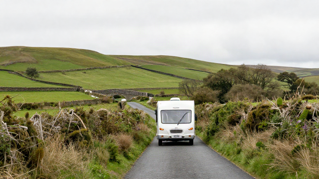
Narrow lanes are the quiet hazard of UK touring. A road can be perfectly legal, and still be miserable in a large motorhome with an oncoming car and no passing place. Campsite entrances are their own test - a sharp turn, a low branch or a tight gateway can undo a good day's driving.
The fix is preparation. Plan the approach into a site, not just the journey to the postcode, and use routes that favour wider roads where the distance cost is small. A campsite finder built into a UK touring app helps here too, because it shows you the site, its access and its location together - so you arrive knowing what the last half-mile looks like.
Do I need an app with offline maps in rural areas?
Yes, if you tour beyond the well-covered corridors. Signal in the hills, in the national parks and along stretches of coast can be patchy, and a nav app that needs a live connection can leave you guessing at exactly the wrong moment. Offline mapping keeps the route and your vehicle profile available when the bars disappear.
How is a UK touring app different from a free car nav app?
Three things matter for a motorhome or caravan owner:
- Vehicle-aware routing: your height, width, weight and length shape every route, not a generic car profile.
- Campsite coverage: a UK campsite finder with thousands of sites, so planning where to stay sits alongside planning how to get there.
- Live traffic and in-car use: live traffic updates and Apple CarPlay support, so the guidance appears on the dashboard screen you already use.
A free car app gives you a map. A purpose-built touring app gives you a route that fits your vehicle - and the reassurance to take the scenic road rather than dreading it.
Can I try it before I pay?
Yes. The app is free for 7 days, then GBP 3.99 per month on iPhone and iPad, with no long tie-in. That gives you a full trip's worth of real routing to decide whether vehicle-aware navigation earns its place on your dashboard.
The short version
Enter your true dimensions - roof vents, mirrors and all - add a small safety margin, and let a vehicle-aware app do the route planning. Trust the signs over the screen, plan the campsite approach as carefully as the journey, and keep offline maps ready for the rural stretches. Do those four things and the low bridge you used to worry about becomes a road you simply never get sent down.
Touring should feel like freedom. The right navigation app is the difference between hoping the road suits your motorhome and knowing it does. Start your free 7-day trial and plan your next trip with your vehicle's real dimensions in the driving seat.